![图片[1]-Data Collection with Spraying Drones: Revolutionizing Farm Analytics-msoen](https://www.msoen.com/wp-content/uploads/2025/04/0f937885e9184642-1024x849.jpg)
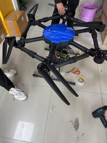
Agricultural drones have evolved beyond mere spraying tools—they’re now powerful data collectors that unlock actionable insights for precision farming. By combining chemical application with real-time field analytics, modern spraying drones are transforming how farmers monitor crops, optimize resources, and predict yields. This article explores the dual role of spraying drones in data-driven agriculture and how this synergy is reshaping farm management.
The Dual Role of Spraying Drones: Spray + Sense
Modern agricultural drones serve two critical functions:
- Precision Spraying: Applying pesticides, fertilizers, or herbicides with centimeter-level accuracy.
- Data Collection: Gathering multispectral, thermal, and spatial data to assess crop health, soil conditions, and environmental factors.
This combination allows farmers to act on insights immediately, creating a closed-loop system of treatment and analysis.
Key Data Types Collected by Spraying Drones
- Crop Health Monitoring
- Multispectral Imagery: Captures visible and near-infrared (NIR) light to calculate NDVI (Normalized Difference Vegetation Index), revealing plant stress, chlorophyll levels, and growth patterns.
- Thermal Imaging: Identifies water stress by detecting temperature variations across fields.
- Soil & Topography Mapping
- 3D Elevation Models: LiDAR or photogrammetry creates detailed terrain maps to assess drainage, erosion risks, and slope stability.
- Soil Moisture: Integrates with ground sensor data to map moisture distribution.
- Pest & Disease Detection
- Hyperspectral Sensors: Detect early signs of fungal infections (e.g., powdery mildew) or pest infestations (e.g., aphid clusters) invisible to the naked eye.
- AI-Powered Analysis: Algorithms flag anomalies in canopy structure or coloration linked to specific threats.
- Spray Efficacy Metrics
- Droplet Coverage Analysis: Cameras record spray distribution to identify under-dosed or over-saturated zones.
- Drift Detection: Tracks unintended chemical movement to adjust future applications.
How Data Enhances Spraying Operations
- Targeted Chemical Application
Data from previous flights identifies high-risk zones (e.g., nutrient-deficient areas, pest hotspots), enabling variable-rate spraying that reduces chemical use by 20–40%. - Predictive Maintenance
Drones monitor their own performance—battery health, nozzle wear, motor efficiency—to schedule maintenance before failures disrupt operations. - Adaptive Flight Planning
Real-time weather data (wind speed, humidity) adjusts flight paths and spray parameters mid-mission to minimize drift and evaporation. - Yield Forecasting
Historical crop health data, combined with spray records, trains AI models to predict harvest volumes and quality.
Technologies Powering Data-Enabled Spraying Drones
- Sensor Fusion Systems
- Multispectral + RGB Cameras: Capture both visual and plant health data in a single flight.
- LiDAR + GPS: Ensures precise altitude control and terrain mapping.
- Edge Computing
Onboard processors analyze data in real time, allowing immediate adjustments without relying on cloud connectivity. - Farm Management Software Integration
Data syncs with platforms like FarmLogs or Agrivi, correlating drone insights with soil tests, irrigation schedules, and machinery data. - Blockchain for Traceability
Spray records and crop data are encrypted and stored on blockchain, enabling transparent sustainability reporting for regulators or buyers.
Benefits of Integrated Data Collection & Spraying
- Cost Savings: Fewer chemical inputs, reduced labor, and optimized irrigation.
- Sustainability: Lower environmental impact through precise chemical use and water conservation.
- Higher Yields: Early detection of threats and data-driven interventions boost crop quality.
- Regulatory Compliance: Automated logs simplify audits for organic certifications or agrochemical regulations.
Case Study: Data-Driven Success in Row Crop Farming
A 1,000-acre soybean farm in Brazil used spraying drones equipped with multispectral sensors to:
- Detect nitrogen deficiency in 15% of the field, directing variable-rate fertilization.
- Reduce fungicide use by 35% by targeting only mildew-prone zones.
- Increase yield by 18% through improved plant health monitoring.
Challenges in Data Management
- Data Overload: High-resolution imagery generates terabytes of data; cloud storage and AI filtering are essential.
- Privacy Concerns: Ensuring farm data security against unauthorized access.
- Skill Gaps: Farmers need training to interpret complex datasets and integrate them into decision-making.
Future Trends in Agricultural Data Collection
- AI-Driven Prescriptions: Drones that recommend spray mixes and rates autonomously based on field data.
- 5G Connectivity: Ultra-fast data transfer for real-time collaboration with agronomists.
- Swarm Learning: Fleets of drones sharing data to improve collective AI accuracy across regions.
- Carbon Footprint Analytics: Drones calculate emission reductions from precision practices for carbon credit programs.
Conclusion
Spraying drones are no longer just crop treatment tools—they’re intelligent data hubs that empower farmers to make smarter, faster decisions. By merging precise chemical application with granular field analytics, these systems reduce waste, enhance sustainability, and maximize profitability. As sensor tech, AI, and connectivity advance, the line between spraying and sensing will blur further, cementing drones as indispensable allies in the quest for climate-resilient, data-driven agriculture.
For farmers, embracing this dual-purpose technology isn’t just an upgrade; it’s a strategic leap toward future-proofing their operations in an era of scarce resources and evolving consumer demands


暂无评论内容