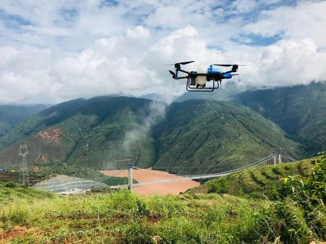
On August 1st, in the demonstration field of the national digital agriculture project in Tangyi Town, the 51st Regiment of the Third Division of the Xinjiang Production and Construction Corps, technicians were providing timely feedback to farmers on the cotton field information collected and analyzed by remote sensing drones, And provide suggestions for field management and protection.
This is the result of using the integrated remote sensing technology of “sky and ground” to carry out large-scale monitoring and diagnosis of cotton growth. A few minutes ago, a remote sensing drone circled along a predetermined route and climbed to a preset altitude. Through its equipped LiDAR sensors, it quickly measured and modeled the terrain of farmland, providing accurate basic data for crop growth and management.
At the same time, using multispectral sensors, remote sensing drones can capture images of farmland, perform image processing and analysis on computers, and quickly detect problems such as diseases, pests, malnutrition, and water scarcity.
From the takeoff of the remote sensing drone to the completion of the measurement, only half an hour was spent collecting data on the growth of cotton in thousands of acres of cotton fields. Technicians then analyze and process the collected information, combined with recent weather trends, to provide farmers with scientific and effective field management plans.
At present, it is one of the key stages for cotton yield formation, and the regulation of water and fertilizer is crucial. We use remote sensing data from drones to collect spectral characteristics of cotton canopy, and then process and analyze the data to obtain the basic content of nitrogen elements on cotton leaves. “Digital Agriculture Project Engineer Zhou Hao said, Based on the analysis results, provide point-to-point guidance to farmers to ensure nutrient supply during cotton production and ultimately achieve good yield returns.
Entering August, cotton growth generally enters the flowering and boll stage, during which cotton requires a large amount of water and fertilizer, accounting for 60-70% of the entire growth period. Scientific allocation of existing water resources and adherence to “small water volume, short cycle” rapid rotation irrigation can reduce the adverse effects of high temperature and water scarcity on cotton growth.
Based on the data collected by remote sensing drones, it is possible to have a more intuitive understanding of the water, fertilizer, diseases, and pests in cotton fields covering thousands of acres or even a larger area, thereby achieving precise fertilization and irrigation, promoting the transformation of traditional agriculture to modern agriculture, and achieving increased agricultural efficiency and employee income.
Through this remote sensing imaging map, we can clearly see which land is lacking in water and which land is lacking in fertilizer. In the later management, areas lacking in water and fertilizer should be promptly replenished with water and fertilizer, so that the yield of cotton will become higher and higher. “said Maierdan Kashengmu, a cotton flower planting farmer in Tangyi Town, 51st Regiment.
In recent years, Tumushuke City in the Third Division has adhered to the development concept of “excellent cotton”, relying on high standard farmland to vigorously build high yield and efficient cotton fields. The process of large-scale planting, standardized production, and industrial development of the cotton industry has been continuously accelerating. With the deep integration of “Internet of Things+Agriculture” with informatization, intelligence, and intelligence in agriculture, modern agricultural technology and big data have made agricultural production in Tumushuke City, the third division, more “technological”.


No reply content