
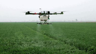
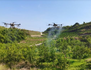
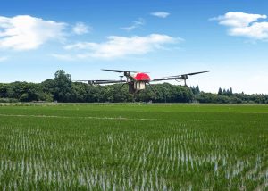
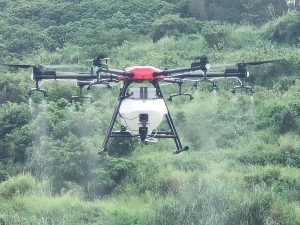
1. Crop spraying
Compared with the traditional pesticide spraying operation mode, the plant protection UAV can achieve automatic quantitative, accurate control and low spraying of pesticides, and the operation efficiency is 8 times that of the overhead spray. The downward airflow generated by the rotor when the UAV sprays drugs can help increase the penetration of drugs to crops, save 30% – 50% of pesticides, save 90% of water consumption, and reduce the pollution of pesticides to soil and environment.
2. Crop seeding
The agricultural UAV operation gradually developed in recent years has fully demonstrated its advantages in fertilizer application and seeding. Compared with traditional agricultural machinery, UAV seeding and fertilization have the characteristics of high accuracy and efficiency, which frees farmers from heavy plant protection operations, facilitates large-scale production, transfer and transportation, and is again not limited by terrain conditions, and is deeply welcomed by farmers.
3. Farmland irrigation
In the process of crop growth, farmers must understand, master and adjust the most suitable soil moisture for crop growth at any time and place. The multi-axis UAV is used to fly over the field and observe the different color changes of farmland soil with different humidity, so as to understand and master the changes of soil moisture with different humidity. At this time, it is necessary to make a set of digital atlas according to the different colors of farmland soil with different humidity and store it in the database for use, In this way, the problem of scientific and reasonable irrigation water can be solved by identifying and comparing the information obtained from multi-axis UAV aerial sampling with the information stored in the database. In addition, the multi-axis UAV can also be used to observe the withering phenomenon of plant leaves, leaf stems and tender shoots caused by the lack of soil moisture in the field as a reference to determine whether the crops need irrigation, so as to achieve the purpose of scientific irrigation and water conservation.
4. Farmland information monitoring
UAV farmland information monitoring mainly includes disease and insect monitoring, irrigation monitoring and crop growth monitoring, etc. It is to fully and comprehensively understand the growth environment, cycle and other indicators of crops from aerial photos and camera data through aerial photography of large areas of farmland and land using space information technology based on remote sensing technology, from irrigation to soil variation, and then to diseases and insect pests and bacterial invasion that cannot be detected by the naked eye, Point out the problem areas, so that farmers can better manage the field. UAV farmland information monitoring has the advantages of large scope, strong timeliness and objective accuracy, which is beyond the reach of conventional monitoring methods.
5. Agricultural insurance survey
Crops are inevitably affected by natural disasters during the growth process, causing damage to farmers. For farmers with small areas of crops, it is not difficult to survey the affected area, but when large areas of crops are subject to natural damage, the workload of crop survey and loss assessment is huge, and the most difficult to accurately define is the loss area. In order to measure the actual disaster area more effectively, agricultural insurance companies carry out the survey of agricultural insurance disaster losses, and apply UAVs to agricultural insurance compensation. The UAV has the technical characteristics of mobile and rapid response, high-resolution image and high-precision positioning data acquisition, application expansion of multiple mission equipment, convenient system maintenance, and can efficiently carry out disaster damage assessment tasks. The insurance company can more accurately measure the actual disaster area by obtaining data from aerial survey, post-processing and technical analysis of aerial photos, and comparing and correcting with the field measurement results. The loss assessment of UAV caused by disasters has solved the problems such as the difficulty of loss assessment and the lack of timeliness in the agricultural insurance compensation, greatly improved the speed of the survey work, saved a lot of manpower and material resources, and ensured the accuracy of the farmland compensation survey while improving the efficiency.

Please sign in to comment
register