
In the high-tech era, drones have taken on new significance. The Food and Agriculture Organization of the United Nations and the International Telecommunication Union have jointly released a new report on drones and agriculture. The editor in chief and information expert Gerald Silvestre of the report said that drones are starting a new agricultural revolution.
According to the report, drones may soon become standard equipment for farm machinery. Here are some examples of many tasks that drones can perform.
1. Crop assessment
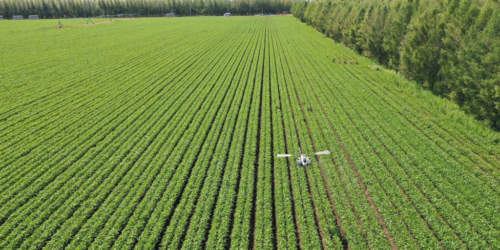
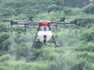
Monitoring farmland is time-consuming and labor-intensive. Drones can fly over entire farmland and evaluate it to find slow-growing plants. Sensors measuring specific wavelengths of light absorbed and reflected by plants can generate color contrast images highlighting problematic areas in the farmland. Based on this, not only can soil, crops, and forests be distinguished, but also diseased plants can be discovered because they reflect different light.
2. Count cattle herds
Ranchers with a large amount of land to take care of are using drones to track livestock and check out fences that need to be repaired. Equipped with high-definition thermal cameras and night vision cameras, drones can also help identify harmful animals that may be harming the herd. In places such as the Kaziranga National Park in India, these drones have also become tools for tracking poachers.
3. Monitoring diseases
If not carefully examined, pathogens that cause crop wilt or otherwise damage crops can be undetected and spread everywhere. Although spectral imaging technology can detect yellow plants in green farmland, Schuler is using drones to search for pathogens that have not yet landed and are floating in the air. He has been able to capture the spores of the fungus Fusarium graminearum, which has flown for several kilometers in the air, which can make wheat and corn sick. If farmers know that there is an outbreak of pathogens in nearby counties, samples collected in the air can alert them of impending pathogens. Federal and state agencies can also monitor pathogens on a larger scale, enabling farmers to be prepared before the outbreak.
4. Water supply observation
Many farmland is not flat. Some areas may have faster land drying rates than others, or may be overlooked by irrigation equipment. Spectral and thermal imaging can reveal arid areas where crops will wither, and imaging equipment can also detect leaks in equipment and irrigation ditches. In addition, with the help of airborne laser scanning technology or software that combines thousands of high-quality aerial photos into 3D maps, farmers can also evaluate the terrain of their land. These maps can identify water bearing areas, reveal the direction of water flow at the bottom of each tree in the orchard, and identify other geomorphic features that affect crop health and whether soil erosion will become a problem.
5. Mechanical pollination
One day, drones may be able to provide assistance to real bees. A start-up company headquartered in New York has developed a drone that spreads pollen to help pollinate almond trees, cherries, and apples. The company claims that its drones can increase the pollination rate by 25% to 65%, but external analysis is still needed to verify these numbers. But some fruit tree growers are optimistic that facts can prove that drones are useful in orchards, especially when real bees hide in their hives during the fruit tree’s flowering window due to cold waves.
Please sign in to comment
register